Flood Risk Has Wiped $42.2 Billion from Australian Property Values
PropTrack and the Climate Council reveal flood risk has wiped $42.2 billion from Australian property values. 1 in 6 homes are at risk, with QLD and NSW worst affected. Insurance premiums are surging and a two-tier market is emerging.

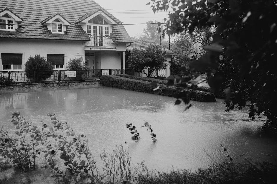
The Scale of the Problem
A landmark 2025 report by PropTrack and the Climate Council has revealed that flood risk has reduced Australian residential property values by a staggering $42.2 billion. This isn’t a future projection — it’s the current market reality, baked into property prices right now.
The analysis found that approximately 1 in 6 Australian homes face some level of flood exposure. Properties in flood-affected areas are trading at persistent discounts, experiencing slower capital growth, and carrying insurance costs that further erode their investment appeal.

For buyers, investors, and conveyancers, the message is stark: flood risk is a financial risk that the market is already pricing in — and many buyers don’t discover it until after settlement.
Which States Are Hardest Hit?
Queensland — The Epicentre

Queensland bears the heaviest burden nationally. Flood-affected properties show value discounts of 5–12% compared to equivalent homes outside flood zones. The 2022 Brisbane floods caused $5.6 billion in insured losses and permanently shifted buyer sentiment across dozens of suburbs.
Key exposure areas include the Brisbane River catchment (Rocklea, Graceville, Chelmer), Townsville’s Ross River corridor, and coastal communities from Bundaberg to Mackay. In many of these suburbs, properties that flooded in 2022 still haven’t recovered their pre-flood values.
New South Wales — Repeated Devastation

NSW carries the second-largest flood risk impact. The Hawkesbury-Nepean valley, Hunter Valley, and Northern Rivers region show the most pronounced effects. In Lismore, property values in the most flood-affected areas have declined by over 20% since the 2022 floods, with some streets seeing even steeper drops.
Western Sydney faces a unique challenge: the Hawkesbury-Nepean is Australia’s highest flood risk basin, with over 130,000 people in the floodplain and projected population growth adding further exposure.
Victoria

The Maribyrnong River flooding in Melbourne (October 2022) put suburban flood risk on the map for Victorian buyers. Gippsland, the Yarra catchment, and parts of regional Victoria along the Murray face recurring exposure. Property discounts of 3–8% are emerging in repeat-flood suburbs.
South Australia
The Murray River corridor saw historic flooding in 2022–23, affecting communities from Renmark to Murray Bridge. Properties along the Lower Murray now carry flood risk premiums that weren’t factored into prices five years ago.
The Insurance Death Spiral
Flood risk doesn’t just hit property values directly. It triggers what the Insurance Council of Australia calls an “affordability crisis” in high-risk areas. Insurance premiums in flood-prone postcodes have increased by 30–80% over the past three years.
The numbers are confronting:
- Annual premiums exceeding $8,000 in some northern Queensland and Northern Rivers postcodes
- Some properties seeing premium-to-value ratios that make them effectively unmarketable to mainstream buyers
- A growing gap between insured and uninsured households, with lower-income communities disproportionately affected
- Insurers withdrawing or restricting cover in the highest-risk zones, creating “insurance deserts”
Without significant government mitigation infrastructure — levees, drainage upgrades, buy-back schemes — premiums in the most exposed areas will continue rising, entrenching a two-tier property market: insurable and uninsurable.
Market Impacts Beyond Price
The PropTrack data shows flood risk affects the property market in ways beyond headline discounts:
- Days on market — flood-zone properties take 15–30% longer to sell compared to low-risk equivalents
- Capital growth drag — high-risk areas underperform comparable low-risk suburbs by 1–3% per year over decade-long periods
- Lending constraints — some lenders are beginning to factor climate risk into loan-to-value ratios, potentially reducing borrowing capacity for high-risk properties
- Rental market effects — tenants in flood-prone areas face displacement risk, leading to higher vacancy rates after events
Why Traditional Due Diligence Falls Short
Standard property searches — title searches, zoning checks, pest and building inspections — don’t typically include comprehensive flood risk data. Council flood maps, where they exist, often rely on outdated modelling that doesn’t account for climate change projections.
Buyers relying on standard due diligence may not discover their property sits in a flood-prone catchment until they receive their first insurance quote — or worse, until floodwaters arrive.
What Smart Buyers and Advisors Are Doing
The shift toward climate-aware property decisions is accelerating. Conveyancers and buyer’s agents are increasingly recommending climate risk assessments as part of standard due diligence, alongside building inspections and strata reports.
A comprehensive climate risk report reveals flood exposure from multiple data sources — including historical flood mapping, elevation analysis, proximity to waterways, drainage basin modelling, and projected rainfall intensity under climate change scenarios.
ClimateNest provides AI-powered flood risk analysis as part of every property report, combining BOM data, CSIRO climate projections, council flood studies, and satellite-derived elevation data to give you a complete picture of your property’s flood exposure — current and future.